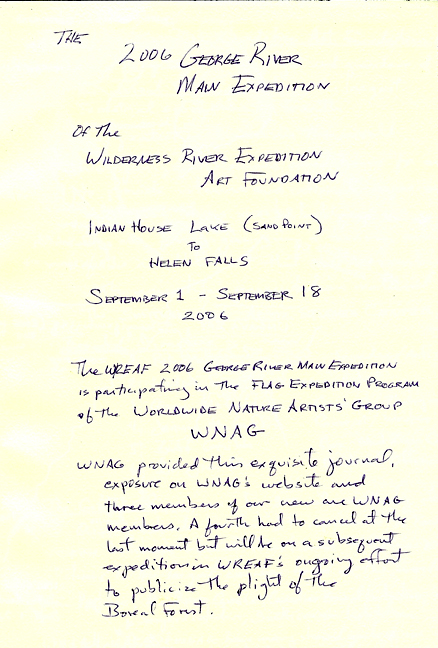
George River, 2006:
On the river September 1 - September 18, 2006
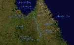
Mushua-ni-pi (Indian House Lake) to Helen Falls
Expedition Logbook
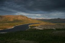
The George River flows northward from Cabot Lake for about 300 miles just west of the Labrador/Quebec border and the Torngat Mountains in Nunavik. Nunavik is the region of Quebec above 55 degrees N Latitude and is administered by First Nations. We put in at Sand Point on Indian House Lake with a full crew of 10. Bob and Stephen could only stay for the first day having last minute commitments elsewhere.
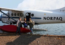
The rest of us continued for 18 days north to Helen Falls where we were met by planes from Norpaq.
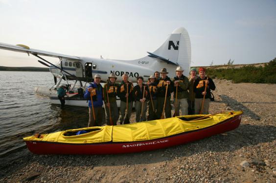
Crew (from left):
Lee Kromschroeder, Gary McGuffin, Robert Bateman, Lindsey Foggett, Joanie McGuffin, Jean-Louis Courteau,
Rob Mullen, John Pitcher, Dr. Stephen Loring and Dr. Jim Evans.
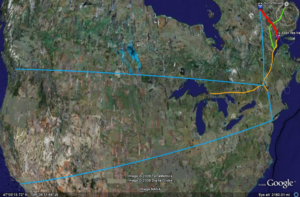
TO THE GEORGE RIVER
(BY TRAIN, PLANE and AUTOMOBILE)
August 29: most of the crew left their various homes for the far north of Quebec. Lindsey, Jim and Lee left Los Angeles for Burlington, Vermont and Gary and Joanie started driving from Goulais River, Ontario. John and Rob waited to rendezvous with the California contingent in Vermont prior to leaving for Sept Iles, Quebec early the next morning and Stephen was racing along the Trans-Labrador Highway also heading for Sept Iles.
August 30: Bob was flying from Vancouver, BC to Montreal. The rest met up in Sept Iles after driving the beautiful northshore of the St. Lawrence River through Quebec prior to boarding the train to Schefferville.
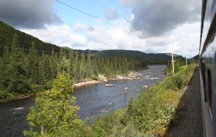
August 31: we boarded Tshiuetin Rail Transport's train to Schefferville where we would meet with Mario from Norpaq Adventures for our flight to the George River.
The train trip is wonderful; long but with stunning scenery along the Moise River and the lakes, bogs, forests and tundra of the interior.
September 1: After a night spent in a bunkhouse at Norpaq's floatplane base (except for Stephen and Lindsey who were driven out by the stenorous snoring - Stephen slept in an old school bus), half of the crew boarded Norpaq's DeHavilland Otter for the first of our three flights out.
The Canoe Journey Begins
Based on what we had learned on the recon expedition we planned on taking out at Helen Falls. The estuary section had been problematic, it would save us the long portage around the falls and allow several extra days ashore for painting, exploration, photography, fishing and weather delays. Hiking in the surrounding forest and tundra of the George is not to be missed; stunning country. The transport logistics also seemed easier and little if any more expensive, especially with Norpaq's generous support.
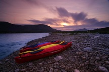
We were flown in by Norpaq to Sand Point on September 1. Bob Bateman met us there by boat as he had flown in the day before and stayed with Norpaq owner Pierre Paquet. We spent the day exploring Innu sites with Stephen Loring, sketching, sorting gear and testing out our Original Bugshirts against the notorious George River Blackflies.
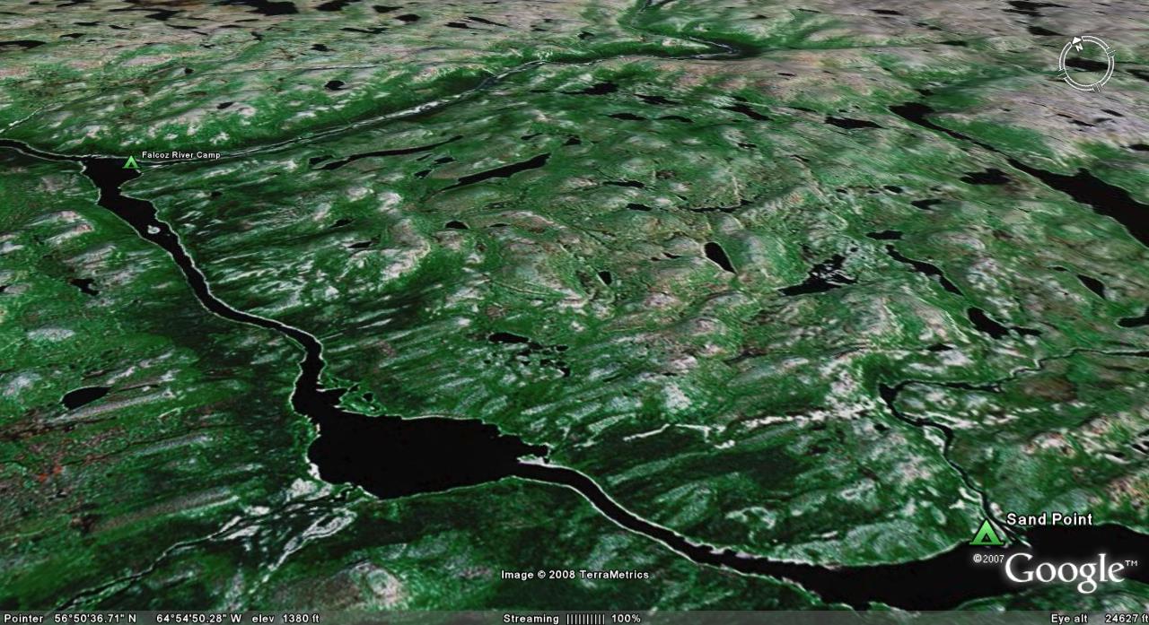
September 2 was very windy so we stayed for more September 2 was very windy so we stayed for more technique for the less experienced members of the crew. On September 3 we set off for the Falcoz River where we planned to spend a full day painting and looking for the wolverine seen on the recon trip.
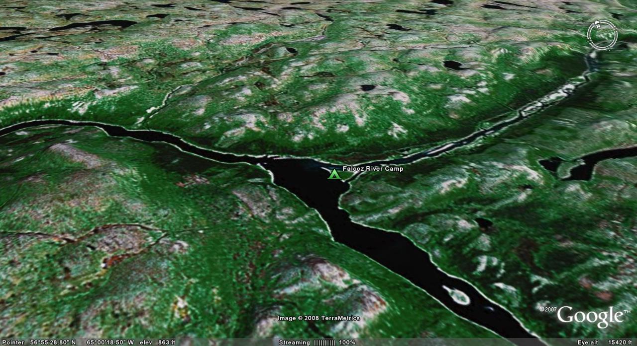
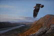
On the 4th most of us hiked up the mountain shown above camp in this orientation. A Golden Eagle flew under us as we were on the top; a unique view of such a magnificent bird. Squalls moved through all day providing dramatic lighting as we all worked on sketching painting and photography.
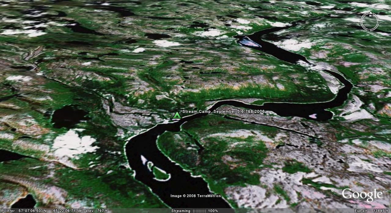
September 5,6,7 and 8 On the Recon in '05 we had been driven to shore on the north end of the island at the bottom of this shot by the remains of Hurricane Katrina. We noted an especially nice looking place to camp just downstream as we left and made it one of our planned two night stays for the main expedition. Bad weather, including our first snowstorm of the trip extended our stay to four nights. We explored the mountain above camp and the long fault line lake to the right of camp on the east shore; Lac Kashauapatshitik where we found what may have been an ancient hunting shelter.
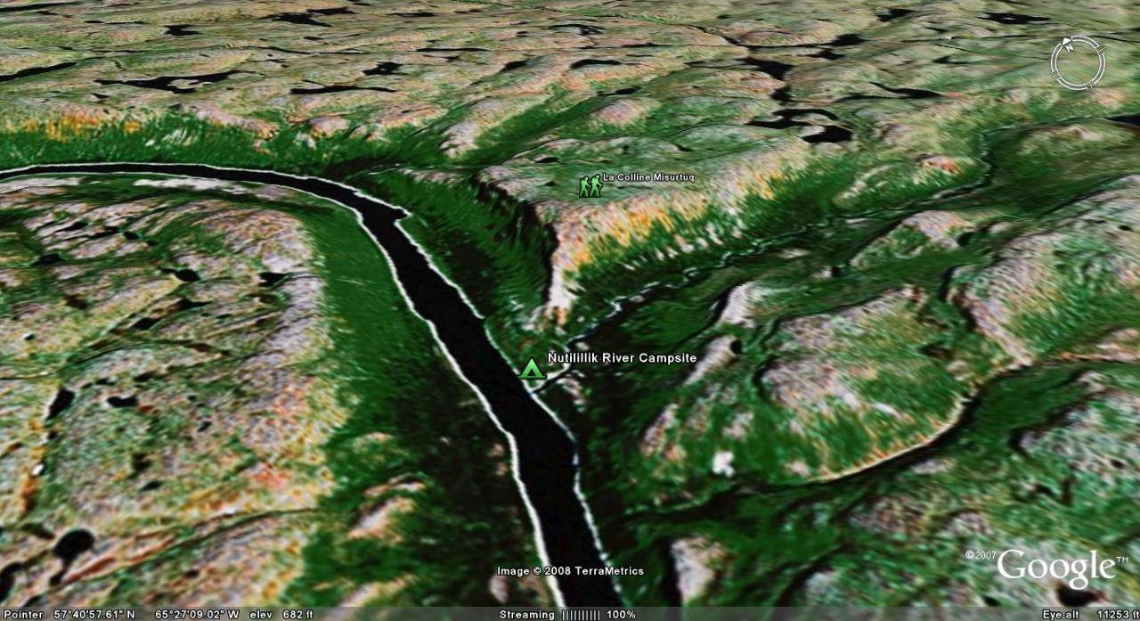
Our camp at the confluence of the Nutilillik and George Rivers with La Colline Misurtuq directly the route Rob, Jim, Lee, Gary and Joanie took to the top. Rob and Jean-Louis did studio paintings of this location and Rob and Lee did field pieces here as well. "Golden Misurtuq", "Eagle Peak" and the "Curious George" paintings are all from this site. The field work were both of the falls on the Nutilillik which were quite dramatic.
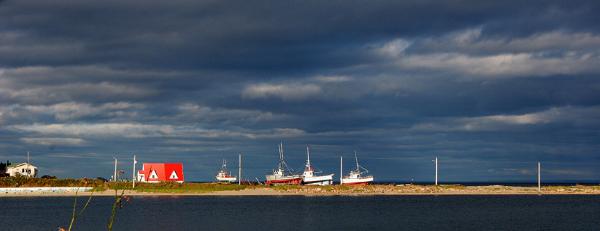
Below: Fishing boats along the St. Lawrence At this point on its run to the sea the river is many miles wide and so marine in character that Tadoussac, QC which we passed through, is famous for whale watching